 vesseltracker.com
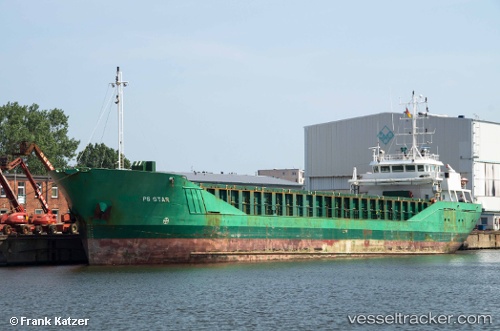
 Vaermland
Current Status
Where is the vessel?
Vaermland is currently in Near Skolwin, based on AIS data received about 1h ago.
Latest AIS update:
Current position: 53.48030° N, 14.61340° E (Near Skolwin)
Average speed (last 7 days): Loading…
Average speed (last 30 days): Loading…
Vessel profile: Vaermland is a Multi Purpose Carrier with dimensions 90m x 12m.
This page combines live AIS, route history, probable destination signals, nearby traffic, and port activity for practical vessel monitoring.
The current position of vessel Vaermland is 53.4803 lat / 14.6134 lng. Updated: 2026-05-14 20:03:49 UTCNearest reference points:
- Near WOLGAST
- Near PEENEMUNDE
- Near KOLOBRZEG
Currently sailing under the flag of Germany ![]()
Vaermland built in 1999 year
Deadweight:
3211 tDetails:
Live Vessel Vaermland Analytics (details, animations, etc.)
Recent AIS points (UTC):
2026-05-14 16:15:41 UTC · 53.48030, 14.61340 · SOG 0 kn · COG 204°2026-05-14 17:24:47 UTC · 53.48030, 14.61340 · SOG 0 kn · COG 204°
2026-05-14 19:42:49 UTC · 53.48030, 14.61340 · SOG 0 kn · COG 204°
2026-05-14 20:03:49 UTC · 53.48030, 14.61340 · SOG 0 kn · COG 204°