 vesseltracker.com
 OPTIMAR
Current Status
Where is the vessel?
OPTIMAR is currently in 31 nm SE of Mörbylånga, based on AIS data received about 1h ago.
Latest AIS update:
Current position: 56.20398° N, 17.14009° E (31 nm SE of Mörbylånga)
Average speed (last 7 days): Loading…
Average speed (last 30 days): Loading…
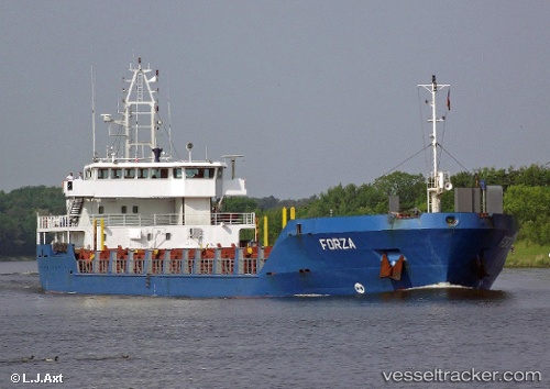
Vessel profile: OPTIMAR is a General Cargo Ship with dimensions 100m x 16m.
This page combines live AIS, route history, probable destination signals, nearby traffic, and port activity for practical vessel monitoring.
The current position of vessel OPTIMAR is 56.20398 lat / 17.14009 lng. Updated: 2026-05-13 11:57:49 UTCNearest reference points:
- 31 nm NW of Ustka
- Near Karlskrona
- Near RONNEBY
Currently sailing under the flag of Cyprus ![]()
OPTIMAR built in 2000 year
Deadweight:
4275 tDetails:
Live Vessel OPTIMAR Analytics (details, animations, etc.)
Recent AIS points (UTC):
2026-05-13 05:43:54 UTC · 55.59999, 15.31370 · SOG 11.5 kn · COG 62°2026-05-13 09:48:51 UTC · 55.98242, 16.52606 · SOG 11.4 kn · COG 61°
2026-05-13 10:51:40 UTC · 56.07871, 16.83457 · SOG 11.4 kn · COG 61°
2026-05-13 11:57:49 UTC · 56.20398, 17.14009 · SOG 11.6 kn · COG 54°