 vesseltracker.com
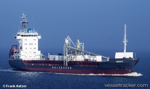
 Cemisle
Current Status
Where is the vessel?
Cemisle is currently in Near Llanwrda, based on AIS data received less than 1h ago.
Latest AIS update:
Current position: 51.92367° N, 3.78132° E (Near Llanwrda)
Average speed (last 7 days): Loading…
Average speed (last 30 days): Loading…
Vessel profile: Cemisle is a Cement Carrier with dimensions m x m.
This page combines live AIS, route history, probable destination signals, nearby traffic, and port activity for practical vessel monitoring.
The current position of vessel Cemisle is 51.92367 lat / 3.78132 lng. Updated: 2026-05-12 19:57:51 UTCNearest reference points:
- Near Haarlemmermeer
- Near DEN OSSE
- Near BROUWERSHAVEN
Currently sailing under the flag of Antigua Barbuda ![]()
Cemisle built in 2000 year
Deadweight:
5183 tDetails:
Live Vessel Cemisle Analytics (details, animations, etc.)
Recent AIS points (UTC):
2026-05-12 17:00:51 UTC · 51.92300, 3.78117 · SOG 0.1 kn · COG 306°2026-05-12 18:10:54 UTC · 51.92400, 3.78133 · SOG 0 kn · COG 268°
2026-05-12 19:22:42 UTC · 51.92367, 3.78133 · SOG 0.3 kn · COG 281°
2026-05-12 19:57:51 UTC · 51.92367, 3.78132 · SOG 0.3 kn · COG 275°