 vesseltracker.com
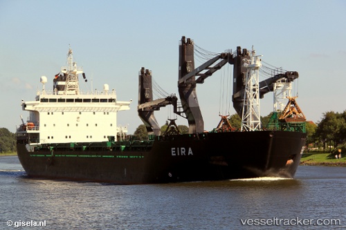
 Eira
Eira
Current Status
Where is the vessel?
Eira is currently in 15 nm NW of Altenkirchen (Rügen), based on AIS data received less than 1h ago.
Latest AIS update:
Current position: 54.81897° N, 13.05922° E (15 nm NW of Altenkirchen (Rügen))
Average speed (last 7 days): Loading…
Average speed (last 30 days): Loading…
Vessel profile: Eira is a General Cargo Ship with dimensions 157m x 25m.
This page combines live AIS, route history, probable destination signals, nearby traffic, and port activity for practical vessel monitoring.
The current position of vessel Eira is 54.81897 lat / 13.05922 lng. Updated: 2026-05-13 04:05:42 UTCNearest reference points:
- Near Breege
- Near Schmedshagen
- Near Trelleborg
Currently sailing under the flag of Finland ![]()
Eira built in 2001 year
Deadweight:
19625 tDetails:
Live Vessel Eira Analytics (details, animations, etc.)
Recent AIS points (UTC):
2026-05-13 01:21:49 UTC · 54.59575, 12.32636 · SOG 10.6 kn · COG 52°2026-05-13 02:16:10 UTC · 54.68537, 12.55338 · SOG 10.4 kn · COG 55°
2026-05-13 03:53:53 UTC · 54.80767, 13.00165 · SOG 10.7 kn · COG 70°
2026-05-13 04:05:42 UTC · 54.81897, 13.05922 · SOG 10.6 kn · COG 70°