 vesseltracker.com
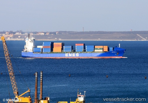
Find the position of the vessel Yigitcan A on the map. The latter are known coordinates and path.
marine traffic ship tracker show on live map
The current position of vessel Yigitcan A is 36.932 lat / 5.36815 lng. Updated: 2024-05-02 14:14:58 UTCCurrently sailing under the flag of Malta
Yigitcan A built in 2001 year
Port of registry:
İzmir (city in İzmir Province, Turkey)Deadweight:
17264 tGross tonnage:
14193Operator:
ARKAS Line (shipping company of Turkey)Service entry:
2001-01-01T00:00:00ZManufacturer:
Peene-Werft (German company)
Details:
Last coordinates of the vessel:
UTC, 36.9417, 5.26167, course: -1, speed: 2UTC, 36.9417, 5.26167, course: -1, speed: 2
UTC, 36.9351, 5.34048, course: 209, speed: 1.6
2024-05-02 14:14:58 UTC, 36.932, 5.36815, course: 202, speed: 1.4