 vesseltracker.com
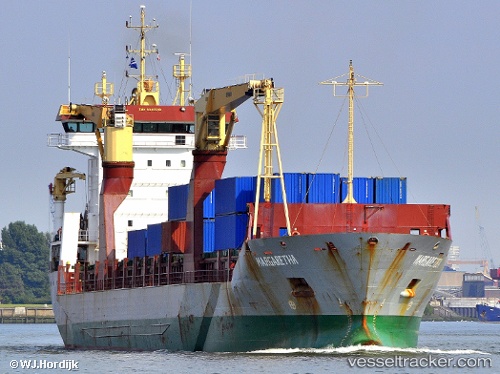
 Margaretha
Current Status
Where is the vessel?
Margaretha is currently in 21 nm S of Ferring, based on AIS data received about 1h ago.
Latest AIS update:
Current position: 50.45548° N, 0.32748° W (21 nm S of Ferring)
Average speed (last 7 days): Loading…
Average speed (last 30 days): Loading…
Vessel profile: Margaretha is a Multi Purpose Carrier with dimensions 145m x 19m.
This page combines live AIS, route history, probable destination signals, nearby traffic, and port activity for practical vessel monitoring.
The current position of vessel Margaretha is 50.45548 lat / -0.32748 lng. Updated: 2026-03-27 09:47:44 UTCNearest reference points:
- 23 nm S of Ferring
- 27 nm S of Seaford
- 15 nm S of Selsey
Currently sailing under the flag of Antigua Barbuda ![]()
Margaretha built in 2002 year
Deadweight:
10526 tDetails:
Live Vessel Margaretha Analytics (details, animations, etc.)
Recent AIS points (UTC):
2026-03-27 01:51:44 UTC · 50.90642, 1.14226 · SOG 8 kn · COG 229°2026-03-27 03:51:24 UTC · 50.75124, 0.83059 · SOG 7.6 kn · COG 231°
2026-03-27 06:23:03 UTC · 50.58701, 0.38696 · SOG 6.1 kn · COG 253°
2026-03-27 09:47:44 UTC · 50.45548, -0.32748 · SOG 6.1 kn · COG 255°