 vesseltracker.com
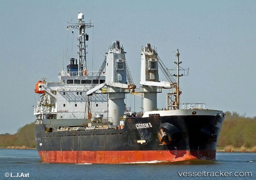
 A LINE
Current Status
Where is the vessel?
A LINE is currently in Near Choueifat, based on AIS data received about 1h ago.
Latest AIS update:
Current position: 33.81861° N, 35.49621° E (Near Choueifat)
Average speed (last 7 days): Loading…
Average speed (last 30 days): Loading…
Vessel profile: A LINE is a Bulk Carrier with dimensions m x m.
This page combines live AIS, route history, probable destination signals, nearby traffic, and port activity for practical vessel monitoring.
The current position of vessel A LINE is 33.81861 lat / 35.49621 lng. Updated: 2026-05-15 19:28:38 UTCNearest reference points:
- Near DBAIYEH
- Near Zouk
- Near Tripoli
Currently sailing under the flag of Barbados ![]()
Details:
Live Vessel A LINE Analytics (details, animations, etc.)
Recent AIS points (UTC):
2026-05-15 15:07:19 UTC · 33.81860, 35.49641 · SOG 0.1 kn · COG 270°2026-05-15 17:59:49 UTC · 33.81874, 35.49631 · SOG 0.6 kn · COG 261°
2026-05-15 19:19:58 UTC · 33.81862, 35.49633 · SOG 0 kn · COG 268°
2026-05-15 19:28:38 UTC · 33.81861, 35.49621 · SOG 1.5 kn · COG 265°