 vesseltracker.com
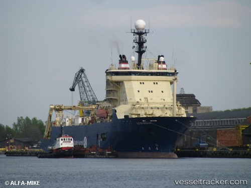
Ile De Brehat
Current StatusWhere is the vessel?
Ile De Brehat is currently in Near Port Raysut, based on AIS data received about 1h ago.
Latest AIS update:
Current position: 16.91089° N, 54.07558° E (Near Port Raysut)
Average speed (last 7 days): Loading…
Average speed (last 30 days): Loading…
Vessel profile: Ile De Brehat is a Cable Layer with dimensions 23m x 140m.
This page combines live AIS, route history, probable destination signals, nearby traffic, and port activity for practical vessel monitoring.
The current position of vessel Ile De Brehat is 16.91089 lat / 54.07558 lng. Updated: 2026-05-02 19:11:12 UTCNearest reference points:
- 103 nm S of Port Raysut
- 106 nm S of Port Raysut
- 110 nm NE of Gross Koris
Details:
Live Vessel Ile De Brehat Analytics (details, animations, etc.)
Recent AIS points (UTC):
2026-05-02 15:44:15 UTC · 16.91112, 54.07546 · SOG 0 kn · COG 253°2026-05-02 15:44:15 UTC · 16.91112, 54.07546 · SOG 0 kn · COG 253°
2026-05-02 19:11:12 UTC · 16.91089, 54.07558 · SOG 0 kn · COG 257°
2026-05-02 19:11:12 UTC · 16.91089, 54.07558 · SOG 0 kn · COG 257°