 vesseltracker.com
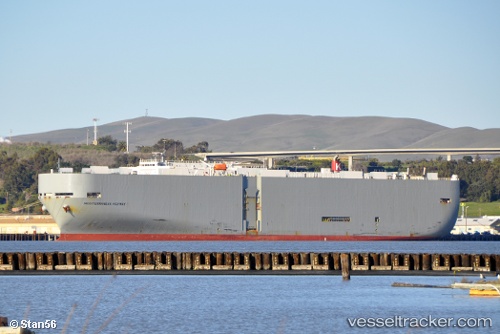
 Mediterraneanhighway
Current Status
Where is the vessel?
Mediterraneanhighway is currently in 25 nm S of Six-Fours-les-Plages, based on AIS data received about 1h ago.
Latest AIS update:
Current position: 42.67943° N, 5.72668° E (25 nm S of Six-Fours-les-Plages)
Average speed (last 7 days): Loading…
Average speed (last 30 days): Loading…
Vessel profile: Mediterraneanhighway is a Vehicles Carrier with dimensions 200m x 32m.
This page combines live AIS, route history, probable destination signals, nearby traffic, and port activity for practical vessel monitoring.
The current position of vessel Mediterraneanhighway is 42.67943 lat / 5.72668 lng. Updated: 2026-04-02 18:17:56 UTCNearest reference points:
- Near Six-Fours-les-Plages
- Near SAINT MANDRIER
- 23 nm SW of Toulon
Currently sailing under the flag of Panama ![]()
Mediterraneanhighway built in 2002 year
Deadweight:
17228 tDetails:
Live Vessel Mediterraneanhighway Analytics (details, animations, etc.)
Recent AIS points (UTC):
2026-04-02 12:01:17 UTC · 42.75833, 7.23667 · SOG 11 kn · COG -1°2026-04-02 13:59:36 UTC · 42.60857, 6.76337 · SOG 11.2 kn · COG 252°
2026-04-02 15:25:16 UTC · 42.52333, 6.41667 · SOG 11 kn · COG -1°
2026-04-02 18:17:56 UTC · 42.67943, 5.72668 · SOG 11 kn · COG 305°