 vesseltracker.com
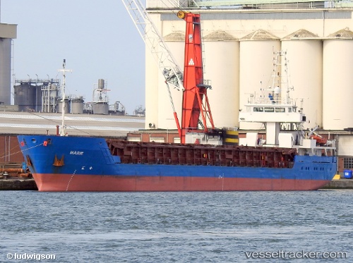
 Marie
Marie
Current Status
Where is the vessel?
Marie is currently in 25 nm SW of Bangor, based on AIS data received less than 1h ago.
Latest AIS update:
Current position: 46.97245° N, 3.51191° W (25 nm SW of Bangor)
Average speed (last 7 days): Loading…
Average speed (last 30 days): Loading…
Vessel profile: Marie is a General Cargo Ship with dimensions 89m x 12m.
This page combines live AIS, route history, probable destination signals, nearby traffic, and port activity for practical vessel monitoring.
The current position of vessel Marie is 46.97245 lat / -3.51191 lng. Updated: 2026-05-12 21:31:52 UTCNearest reference points:
- Near Saint-Pierre-Quiberon
- Near QUIBERON
- Near Lorient
Currently sailing under the flag of Belgium ![]()
Marie built in 2002 year
Deadweight:
2974 tDetails:
Live Vessel Marie Analytics (details, animations, etc.)
Recent AIS points (UTC):
2026-05-12 17:59:51 UTC · 46.70565, -2.80428 · SOG 9.6 kn · COG 303°2026-05-12 19:13:54 UTC · 46.80100, -3.05518 · SOG 9.6 kn · COG 299°
2026-05-12 20:05:52 UTC · 46.86640, -3.23042 · SOG 9 kn · COG 303°
2026-05-12 21:31:52 UTC · 46.97245, -3.51191 · SOG 8.8 kn · COG 301°