 vesseltracker.com
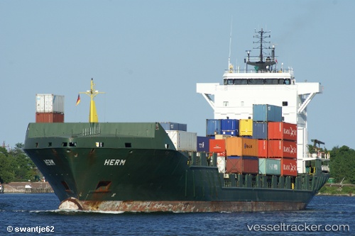
 ENERGY
Current Status
Where is the vessel?
ENERGY is currently in Near Mölle, based on AIS data received less than 1h ago.
Latest AIS update:
Current position: 56.37459° N, 12.33995° E (Near Mölle)
Average speed (last 7 days): Loading…
Average speed (last 30 days): Loading…
Vessel profile: ENERGY is a Container Ship with dimensions 135m x 21m.
This page combines live AIS, route history, probable destination signals, nearby traffic, and port activity for practical vessel monitoring.
The current position of vessel ENERGY is 56.37459 lat / 12.33995 lng. Updated: 2026-05-12 20:00:17 UTCNearest reference points:
- Near Viken
- 11 nm NW of Tisvilde
- Near Helsingor
Currently sailing under the flag of Portugal (MAR) ![]()
ENERGY built in 2004 year
Deadweight:
9368 tDetails:
Live Vessel ENERGY Analytics (details, animations, etc.)
Recent AIS points (UTC):
2026-05-12 17:01:27 UTC · 55.75841, 12.70019 · SOG 13.5 kn · COG 13°2026-05-12 18:12:06 UTC · 56.00932, 12.67794 · SOG 12.7 kn · COG 344°
2026-05-12 19:22:42 UTC · 56.22757, 12.42885 · SOG 14.9 kn · COG 343°
2026-05-12 20:00:17 UTC · 56.37459, 12.33995 · SOG 14.7 kn · COG 347°