 vesseltracker.com
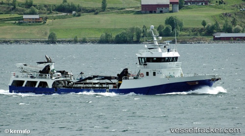
 Langsund
Current Status
Where is the vessel?
Langsund is currently in Near Volda, based on AIS data received about 1h ago.
Latest AIS update:
Current position: 62.10680° N, 6.07931° E (Near Volda)
Average speed (last 7 days): Loading…
Average speed (last 30 days): Loading…
Vessel profile: Langsund is a Fish Carrier with dimensions 58m x 10m.
This page combines live AIS, route history, probable destination signals, nearby traffic, and port activity for practical vessel monitoring.
The current position of vessel Langsund is 62.10680 lat / 6.07931 lng. Updated: 2026-05-13 14:24:28 UTCNearest reference points:
- Near Alesund
- Near Fiskarstrand
- Near Gjøsundet
Currently sailing under the flag of Norway ![]()
Langsund built in 2001 year
Deadweight:
650 tDetails:
Live Vessel Langsund Analytics (details, animations, etc.)
Recent AIS points (UTC):
2026-05-13 10:50:07 UTC · 62.34143, 6.11117 · SOG 9.1 kn · COG 211°2026-05-13 12:00:26 UTC · 62.19207, 5.93755 · SOG 9.3 kn · COG 144°
2026-05-13 13:47:46 UTC · 62.10690, 6.07913 · SOG 0 kn · COG 357°
2026-05-13 14:24:28 UTC · 62.10680, 6.07931 · SOG 0.3 kn · COG 313°