 vesseltracker.com
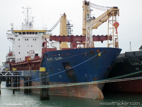
 Atlantic Island
Current Status
Where is the vessel?
Atlantic Island is currently in Near PAPENBURG, based on AIS data received about 1d ago.
Latest AIS update:
Current position: 53.09147° N, 7.37910° E (Near PAPENBURG)
Average speed (last 7 days): Loading…
Average speed (last 30 days): Loading…
Vessel profile: Atlantic Island is a General Cargo Ship with dimensions 95m x 95m.
This page combines live AIS, route history, probable destination signals, nearby traffic, and port activity for practical vessel monitoring.
The current position of vessel Atlantic Island is 53.09147 lat / 7.37910 lng. Updated: 2026-05-15 08:54:40 UTCNearest reference points:
- Near Emden
- Near APPINGEDAM
- Near NORDDEICH
Currently sailing under the flag of Cyprus ![]()
Atlantic Island built in 2002 year
Deadweight:
5000 tDetails:
Live Vessel Atlantic Island Analytics (details, animations, etc.)
Recent AIS points (UTC):
2026-05-15 08:54:40 UTC · 53.09147, 7.37910 · SOG 0 kn · COG 184°2026-05-15 08:54:40 UTC · 53.09147, 7.37910 · SOG 0 kn · COG 184°
2026-05-15 08:54:40 UTC · 53.09147, 7.37910 · SOG 0 kn · COG 184°
2026-05-15 08:54:40 UTC · 53.09147, 7.37910 · SOG 0 kn · COG 184°