 vesseltracker.com
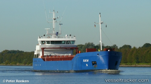
 LAURIERBORG
Current Status
Where is the vessel?
LAURIERBORG is currently in Near Bahrenfeld, based on AIS data received about 1h ago.
Latest AIS update:
Current position: 53.53497° N, 9.95770° E (Near Bahrenfeld)
Average speed (last 7 days): Loading…
Average speed (last 30 days): Loading…
Vessel profile: LAURIERBORG is a General Cargo with dimensions m x m.
This page combines live AIS, route history, probable destination signals, nearby traffic, and port activity for practical vessel monitoring.
The current position of vessel LAURIERBORG is 53.53497 lat / 9.95770 lng. Updated: 2026-05-14 17:24:13 UTCNearest reference points:
- Near Bahrenfeld
- Near Hamburg-Mitte
- Near Allermöhe
Currently sailing under the flag of Netherlands ![]()
Details:
Live Vessel LAURIERBORG Analytics (details, animations, etc.)
Recent AIS points (UTC):
2026-05-14 14:09:18 UTC · 53.53501, 9.95775 · SOG 0 kn · COG 124°2026-05-14 16:06:43 UTC · 53.53504, 9.95778 · SOG 0 kn · COG -1°
2026-05-14 16:15:17 UTC · 53.53504, 9.95776 · SOG 0 kn · COG 124°
2026-05-14 17:24:13 UTC · 53.53497, 9.95770 · SOG 0 kn · COG 124°