 vesseltracker.com
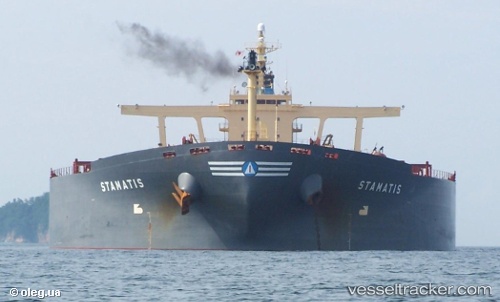
 SUNNY KANKAN
Current Status
Where is the vessel?
SUNNY KANKAN is currently in 38 nm E of Longyan Pt, based on AIS data received less than 1h ago.
Latest AIS update:
Current position: 37.49819° N, 123.41744° E (38 nm E of Longyan Pt)
Average speed (last 7 days): Loading…
Average speed (last 30 days): Loading…
Vessel profile: SUNNY KANKAN is a Bulk Carrier with dimensions m x m.
This page combines live AIS, route history, probable destination signals, nearby traffic, and port activity for practical vessel monitoring.
The current position of vessel SUNNY KANKAN is 37.49819 lat / 123.41744 lng. Updated: 2026-04-24 07:23:43 UTCNearest reference points:
- 34 nm E of Longyan Pt
- 30 nm E of Longyan Pt
- 54 nm E of Longyan Pt
Currently sailing under the flag of Liberia ![]()
Details:
Live Vessel SUNNY KANKAN Analytics (details, animations, etc.)
Recent AIS points (UTC):
2026-04-24 03:42:33 UTC · 37.84220, 122.71192 · SOG 10.9 kn · COG 115°2026-04-24 04:36:03 UTC · 37.82194, 122.91884 · SOG 11.8 kn · COG 91°
2026-04-24 05:44:44 UTC · 37.74213, 123.15737 · SOG 11.3 kn · COG 139°
2026-04-24 07:23:43 UTC · 37.49819, 123.41744 · SOG 12.1 kn · COG 146°