 vesseltracker.com
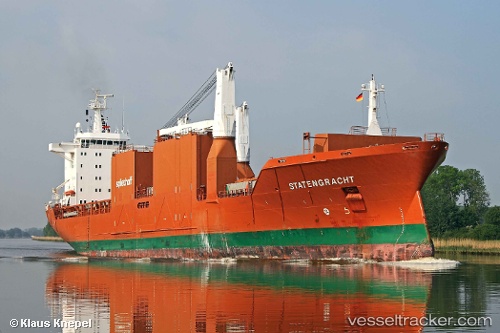
 Statengracht
Current Status
Where is the vessel?
Statengracht is currently in 91 nm N of Bommes, based on AIS data received less than 1h ago.
Latest AIS update:
Current position: 45.99808° N, 21.46258° W (91 nm N of Bommes)
Average speed (last 7 days): Loading…
Average speed (last 30 days): Loading…
Vessel profile: Statengracht is a Multi Purpose Carrier with dimensions 172m x 25m.
This page combines live AIS, route history, probable destination signals, nearby traffic, and port activity for practical vessel monitoring.
The current position of vessel Statengracht is 45.99808 lat / -21.46258 lng. Updated: 2026-05-13 02:32:31 UTCCurrently sailing under the flag of Netherlands ![]()
Statengracht built in 2004 year
Deadweight:
21250 tDetails:
Live Vessel Statengracht Analytics (details, animations, etc.)
Recent AIS points (UTC):
2026-05-12 22:04:16 UTC · 46.40881, -20.10891 · SOG 13.7 kn · COG 245°2026-05-12 23:18:00 UTC · 46.28661, -20.48028 · SOG 13.9 kn · COG 247°
2026-05-13 01:02:15 UTC · 46.13608, -21.01477 · SOG 13.6 kn · COG 245°
2026-05-13 02:32:31 UTC · 45.99808, -21.46258 · SOG 13.2 kn · COG 245°