 vesseltracker.com
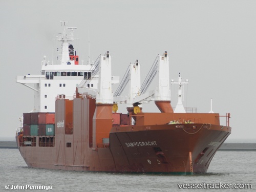
 Sampogracht
Current Status
Where is the vessel?
Sampogracht is currently in 64 nm S of Grand Banks South, based on AIS data received less than 1h ago.
Latest AIS update:
Current position: 41.44486° N, 50.18793° W (64 nm S of Grand Banks South)
Average speed (last 7 days): Loading…
Average speed (last 30 days): Loading…
Vessel profile: Sampogracht is a Multi Purpose Carrier with dimensions 185m x 25m.
This page combines live AIS, route history, probable destination signals, nearby traffic, and port activity for practical vessel monitoring.
The current position of vessel Sampogracht is 41.44486 lat / -50.18793 lng. Updated: 2026-03-29 23:25:56 UTCNearest reference points:
- 63 nm SE of Azuara
- 76 nm SW of Seica
- 28 nm NE of Valencia de San Juan
Currently sailing under the flag of Netherlands ![]()
Sampogracht built in 2005 year
Deadweight:
23688 tDetails:
Live Vessel Sampogracht Analytics (details, animations, etc.)
Recent AIS points (UTC):
2026-03-29 18:01:44 UTC · 41.63915, -48.56922 · SOG 12 kn · COG 255°2026-03-29 19:41:33 UTC · 41.57589, -49.03460 · SOG 13.7 kn · COG 260°
2026-03-29 21:16:33 UTC · 41.53122, -49.51521 · SOG 13.8 kn · COG 262°
2026-03-29 23:25:56 UTC · 41.44486, -50.18793 · SOG 14 kn · COG 261°