 vesseltracker.com
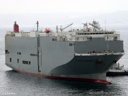
 Tianjin Highway
Current Status
Where is the vessel?
Tianjin Highway is currently in 102 nm S of Diego Garcia, based on AIS data received about 1h ago.
Latest AIS update:
Current position: 8.90116° S, 73.06081° E (102 nm S of Diego Garcia)
Average speed (last 7 days): Loading…
Average speed (last 30 days): Loading…
Vessel profile: Tianjin Highway is a Vehicles Carrier with dimensions 180m x 32m.
This page combines live AIS, route history, probable destination signals, nearby traffic, and port activity for practical vessel monitoring.
The current position of vessel Tianjin Highway is -8.90116 lat / 73.06081 lng. Updated: 2026-05-18 01:57:08 UTCNearest reference points:
- 253 nm S of Diego Garcia
Currently sailing under the flag of Panama ![]()
Tianjin Highway built in 2005 year
Deadweight:
15461 tDetails:
Live Vessel Tianjin Highway Analytics (details, animations, etc.)
Recent AIS points (UTC):
2026-05-17 22:04:34 UTC · -8.31294, 73.93915 · SOG 16.2 kn · COG 237°2026-05-18 00:06:39 UTC · -8.61757, 73.48104 · SOG 16.5 kn · COG 234°
2026-05-18 01:23:03 UTC · -8.81360, 73.19172 · SOG 16.7 kn · COG 235°
2026-05-18 01:57:08 UTC · -8.90116, 73.06081 · SOG 16.4 kn · COG 235°