 vesseltracker.com
 HARVEST
Current Status
Where is the vessel?
HARVEST is currently in 32 nm S of Pinghai, based on AIS data received about 1h ago.
Latest AIS update:
Current position: 22.10456° N, 115.04691° E (32 nm S of Pinghai)
Average speed (last 7 days): Loading…
Average speed (last 30 days): Loading…
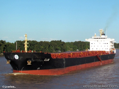
Vessel profile: HARVEST is a Bulk Carrier with dimensions 32m x 225m.
This page combines live AIS, route history, probable destination signals, nearby traffic, and port activity for practical vessel monitoring.
The current position of vessel HARVEST is 22.10456 lat / 115.04691 lng. Updated: 2026-03-26 22:20:21 UTCNearest reference points:
- 14 nm S of Pinghai
- Near Pinghai
- 22 nm E of Wan Tsai
Currently sailing under the flag of Marshall Islands ![]()
HARVEST built in 2005 year
Deadweight:
73691 tDetails:
Live Vessel HARVEST Analytics (details, animations, etc.)
Recent AIS points (UTC):
2026-03-26 15:40:13 UTC · 22.27751, 113.79801 · SOG 14.4 kn · COG 180°2026-03-26 18:12:01 UTC · 21.95086, 114.11665 · SOG 12.7 kn · COG 101°
2026-03-26 19:58:42 UTC · 21.94319, 114.52715 · SOG 12.7 kn · COG 71°
2026-03-26 22:20:21 UTC · 22.10456, 115.04691 · SOG 13 kn · COG 77°