 vesseltracker.com
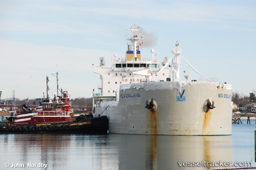
 New England
Current Status
Where is the vessel?
New England is currently in 16 nm E of Annisquam Harbour, based on AIS data received less than 1h ago.
Latest AIS update:
Current position: 42.66034° N, 70.31587° W (16 nm E of Annisquam Harbour)
Average speed (last 7 days): Loading…
Average speed (last 30 days): Loading…
Vessel profile: New England is a Chemical Oil Products Tanker with dimensions 182m x 182m.
This page combines live AIS, route history, probable destination signals, nearby traffic, and port activity for practical vessel monitoring.
The current position of vessel New England is 42.66034 lat / -70.31587 lng. Updated: 2026-05-15 05:46:26 UTCNearest reference points:
- 30 nm E of York Beach
- Near Kittery
- Near Cohasset
Currently sailing under the flag of Marshall Is ![]()
New England built in 2005 year
Deadweight:
37515 tDetails:
Live Vessel New England Analytics (details, animations, etc.)
Recent AIS points (UTC):
2026-05-14 23:31:07 UTC · 42.38515, -71.02417 · SOG 0 kn · COG 236°2026-05-15 03:58:27 UTC · 42.51228, -70.63681 · SOG 8.1 kn · COG 59°
2026-05-15 04:17:07 UTC · 42.53446, -70.58720 · SOG 8.3 kn · COG 59°
2026-05-15 05:46:26 UTC · 42.66034, -70.31587 · SOG 13.7 kn · COG 60°