 vesseltracker.com
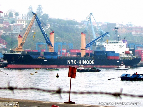
Iyo
Current StatusWhere is the vessel?
Iyo is currently in 361 nm NE of Sundance, based on AIS data received less than 1h ago.
Latest AIS update:
Current position: 28.83753° N, 131.63370° W (361 nm NE of Sundance)
Average speed (last 7 days): Loading…
Average speed (last 30 days): Loading…
Vessel profile: Iyo is a Multi Purpose Carrier with dimensions 24m x 149m.
This page combines live AIS, route history, probable destination signals, nearby traffic, and port activity for practical vessel monitoring.
The current position of vessel Iyo is 28.83753 lat / -131.63370 lng. Updated: 2026-05-15 20:05:03 UTCNearest reference points:
- Open sea, approx. 402 nm off the nearest listed port
- Open sea, approx. 404 nm off the nearest listed port
- Open sea, approx. 405 nm off the nearest listed port
Details:
Live Vessel Iyo Analytics (details, animations, etc.)
Recent AIS points (UTC):
2026-05-15 16:44:25 UTC · 28.73551, -130.93854 · SOG 11 kn · COG 283°2026-05-15 18:05:54 UTC · 28.77778, -131.21667 · SOG 11.1 kn · COG 283°
2026-05-15 19:46:46 UTC · 28.82866, -131.57054 · SOG 11 kn · COG 283°
2026-05-15 20:05:03 UTC · 28.83753, -131.63370 · SOG 11.2 kn · COG 282°