 vesseltracker.com
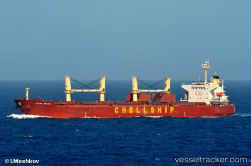
Malahayati Baruna
Current StatusWhere is the vessel?
Malahayati Baruna is currently in 114 nm NW of Camar Marine Terminal, based on AIS data received less than 1h ago.
Latest AIS update:
Current position: 4.69167° S, 111.99667° E (114 nm NW of Camar Marine Terminal)
Average speed (last 7 days): Loading…
Average speed (last 30 days): Loading…
Vessel profile: Malahayati Baruna is a Bulk Carrier with dimensions 32m x 190m.
This page combines live AIS, route history, probable destination signals, nearby traffic, and port activity for practical vessel monitoring.
The current position of vessel Malahayati Baruna is -4.69167 lat / 111.99667 lng. Updated: 2026-05-13 11:35:22 UTCNearest reference points:
- 60 nm NW of Camar Marine Terminal
- 68 nm NW of Gagak Rimang Fso
- 50 nm N of Camar Marine Terminal
Details:
Live Vessel Malahayati Baruna Analytics (details, animations, etc.)
Recent AIS points (UTC):
2026-05-13 05:20:19 UTC · -4.42667, 111.24667 · SOG 7 kn · COG -1°2026-05-13 10:08:19 UTC · -4.62833, 111.81833 · SOG 7 kn · COG -1°
2026-05-13 10:35:20 UTC · -4.64667, 111.87500 · SOG 7 kn · COG -1°
2026-05-13 11:35:22 UTC · -4.69167, 111.99667 · SOG 7 kn · COG -1°