 vesseltracker.com
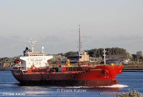
 AURELIAN
Current Status
Where is the vessel?
AURELIAN is currently in 99 nm N of Darnah, based on AIS data received less than 1h ago.
Latest AIS update:
Current position: 34.29809° N, 21.91535° E (99 nm N of Darnah)
Average speed (last 7 days): Loading…
Average speed (last 30 days): Loading…
Vessel profile: AURELIAN is a Oil/Chemical Tanker with dimensions m x m.
This page combines live AIS, route history, probable destination signals, nearby traffic, and port activity for practical vessel monitoring.
The current position of vessel AURELIAN is 34.29809 lat / 21.91535 lng. Updated: 2026-04-24 16:10:42 UTCNearest reference points:
- 85 nm W of Paleochora
- 59 nm W of Paleochora
- 61 nm N of Al Marj
Currently sailing under the flag of Barbados ![]()
Details:
Live Vessel AURELIAN Analytics (details, animations, etc.)
Recent AIS points (UTC):
2026-04-24 13:12:51 UTC · 34.45667, 21.18833 · SOG 12 kn · COG -1°2026-04-24 13:48:47 UTC · 34.42500, 21.32833 · SOG 12 kn · COG -1°
2026-04-24 16:10:42 UTC · 34.29809, 21.91535 · SOG 13.4 kn · COG 105°
2026-04-24 16:10:42 UTC · 34.29809, 21.91535 · SOG 13.4 kn · COG 105°