 vesseltracker.com
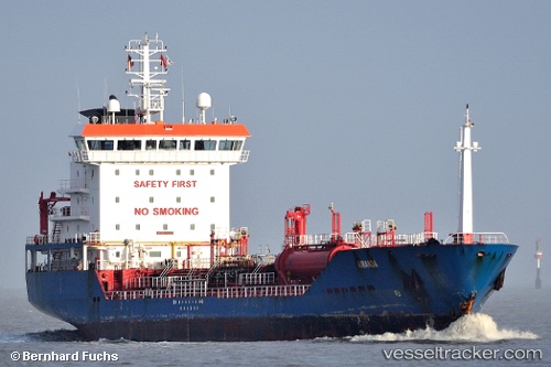
 KARIA
KARIA
Current Status
Where is the vessel?
KARIA is currently in Near Aliaga, based on AIS data received about 1h ago.
Latest AIS update:
Current position: 38.82140° N, 26.96598° E (Near Aliaga)
Average speed (last 7 days): Loading…
Average speed (last 30 days): Loading…
Vessel profile: KARIA is a Chemical/Oil Products Tanker with dimensions 119m x 17m.
This page combines live AIS, route history, probable destination signals, nearby traffic, and port activity for practical vessel monitoring.
The current position of vessel KARIA is 38.82140 lat / 26.96598 lng. Updated: 2026-03-28 15:40:30 UTCNearest reference points:
- Near Aliaga
- Near NEMRUT
- Near Nemrut Bay
Currently sailing under the flag of Turkey ![]()
KARIA built in 2005 year
Deadweight:
6954 tDetails:
Live Vessel KARIA Analytics (details, animations, etc.)
Recent AIS points (UTC):
2026-03-28 10:25:34 UTC · 38.82192, 26.96697 · SOG 0 kn · COG 177°2026-03-28 11:46:31 UTC · 38.82188, 26.96697 · SOG 0 kn · COG 177°
2026-03-28 13:28:31 UTC · 38.82183, 26.96702 · SOG 0 kn · COG 176°
2026-03-28 15:40:30 UTC · 38.82140, 26.96598 · SOG 0 kn · COG 129°