 vesseltracker.com
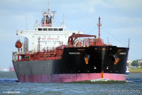
 Chemroad Wing
Current Status
Where is the vessel?
Chemroad Wing is currently in 35 nm S of Mount Pleasant, based on AIS data received about 1h ago.
Latest AIS update:
Current position: 34.57297° S, 25.39301° E (35 nm S of Mount Pleasant)
Average speed (last 7 days): Loading…
Average speed (last 30 days): Loading…
Vessel profile: Chemroad Wing is a Chemical Oil Products Tanker with dimensions 170m x 26m.
This page combines live AIS, route history, probable destination signals, nearby traffic, and port activity for practical vessel monitoring.
The current position of vessel Chemroad Wing is -34.57297 lat / 25.39301 lng. Updated: 2026-05-16 17:29:48 UTCNearest reference points:
- 21 nm S of Mount Pleasant
- Near Deal Party
Currently sailing under the flag of Panama ![]()
Chemroad Wing built in 2005 year
Deadweight:
32051 tDetails:
Live Vessel Chemroad Wing Analytics (details, animations, etc.)
Recent AIS points (UTC):
2026-05-16 14:05:48 UTC · -34.68937, 24.79070 · SOG 8.8 kn · COG 78°2026-05-16 16:11:58 UTC · -34.63221, 25.14223 · SOG 9.3 kn · COG 79°
2026-05-16 16:21:57 UTC · -34.62427, 25.17225 · SOG 9.4 kn · COG 81°
2026-05-16 17:29:48 UTC · -34.57297, 25.39301 · SOG 11.4 kn · COG 78°