 vesseltracker.com
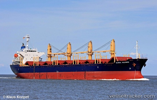
 Amaliya
Current Status
Where is the vessel?
Amaliya is currently in Near Maltepe, based on AIS data received about 2h ago.
Latest AIS update:
Current position: 40.78343° N, 28.98413° E (Near Maltepe)
Average speed (last 7 days): Loading…
Average speed (last 30 days): Loading…
Vessel profile: Amaliya is a Bulk Carrier with dimensions 169m x 27m.
This page combines live AIS, route history, probable destination signals, nearby traffic, and port activity for practical vessel monitoring.
The current position of vessel Amaliya is 40.78343 lat / 28.98413 lng. Updated: 2026-03-28 13:24:58 UTCNearest reference points:
- 10 nm SE of Kumport
- Near Kumport
- 14 nm SW of Maltepe
Currently sailing under the flag of Malta ![]()
Amaliya built in 2004 year
Deadweight:
28436 tDetails:
Live Vessel Amaliya Analytics (details, animations, etc.)
Recent AIS points (UTC):
2026-03-28 07:23:30 UTC · 40.78277, 29.02460 · SOG 0.1 kn · COG 165°2026-03-28 10:25:19 UTC · 40.78335, 29.01297 · SOG 0.5 kn · COG 185°
2026-03-28 11:50:59 UTC · 40.79638, 28.98913 · SOG 1 kn · COG 204°
2026-03-28 13:24:58 UTC · 40.78343, 28.98413 · SOG 8.3 kn · COG -1°