 vesseltracker.com
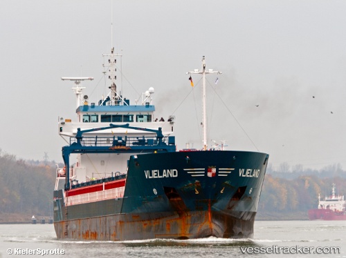
 Vlieland
Current Status
Where is the vessel?
Vlieland is currently in 18 nm W of Molengat, based on AIS data received less than 1h ago.
Latest AIS update:
Current position: 53.03586° N, 4.15732° E (18 nm W of Molengat)
Average speed (last 7 days): Loading…
Average speed (last 30 days): Loading…
Vessel profile: Vlieland is a Multi Purpose Carrier with dimensions 111m x 14m.
This page combines live AIS, route history, probable destination signals, nearby traffic, and port activity for practical vessel monitoring.
The current position of vessel Vlieland is 53.03586 lat / 4.15732 lng. Updated: 2026-03-31 09:59:43 UTCNearest reference points:
- 22 nm W of Schoorl
- 23 nm N of de Ruyter
- Near Molengat
Currently sailing under the flag of Netherlands ![]()
Vlieland built in 2005 year
Deadweight:
6000 tDetails:
Live Vessel Vlieland Analytics (details, animations, etc.)
Recent AIS points (UTC):
2026-03-31 03:26:42 UTC · 53.65961, 5.57189 · SOG 9.5 kn · COG 255°2026-03-31 06:17:13 UTC · 53.51213, 4.88973 · SOG 9.5 kn · COG 250°
2026-03-31 07:26:42 UTC · 53.42967, 4.61059 · SOG 10.7 kn · COG 209°
2026-03-31 09:59:43 UTC · 53.03586, 4.15732 · SOG 11.3 kn · COG 228°