 vesseltracker.com
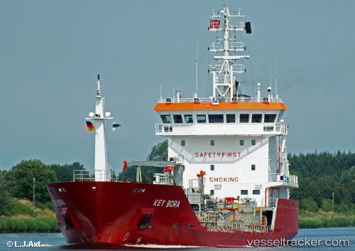
 Key Bora
Current Status
Where is the vessel?
Key Bora is currently in Near Küçükçekmece, based on AIS data received less than 1h ago.
Latest AIS update:
Current position: 40.95692° N, 28.75328° E (Near Küçükçekmece)
Average speed (last 7 days): Loading…
Average speed (last 30 days): Loading…
Vessel profile: Key Bora is a Chemical Oil Products Tanker with dimensions 93m x 14m.
This page combines live AIS, route history, probable destination signals, nearby traffic, and port activity for practical vessel monitoring.
The current position of vessel Key Bora is 40.95692 lat / 28.75328 lng. Updated: 2026-05-16 16:24:23 UTCNearest reference points:
- Near Küçükçekmece
- Near Kumport
- Near Ambarli
Currently sailing under the flag of Gibraltar ![]()
Key Bora built in 2006 year
Deadweight:
3502 tDetails:
Live Vessel Key Bora Analytics (details, animations, etc.)
Recent AIS points (UTC):
2026-05-16 12:16:51 UTC · 41.27828, 28.96850 · SOG 6.1 kn · COG 75°2026-05-16 14:03:11 UTC · 41.17053, 29.07345 · SOG 11.9 kn · COG 221°
2026-05-16 16:12:31 UTC · 40.93951, 28.77415 · SOG 8.7 kn · COG 317°
2026-05-16 16:24:23 UTC · 40.95692, 28.75328 · SOG 5.5 kn · COG 299°