 vesseltracker.com
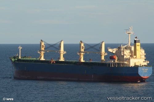
 GUNALEILA
Current Status
Where is the vessel?
GUNALEILA is currently in 39 nm S of Balikpapan, based on AIS data received about 3d ago.
Latest AIS update:
Current position: 1.89014° S, 116.63009° E (39 nm S of Balikpapan)
Average speed (last 7 days): Loading…
Average speed (last 30 days): Loading…
Vessel profile: GUNALEILA is a Bulk Carrier with dimensions 190m x 190m.
This page combines live AIS, route history, probable destination signals, nearby traffic, and port activity for practical vessel monitoring.
The current position of vessel GUNALEILA is -1.89014 lat / 116.63009 lng. Updated: 2026-05-09 22:41:54 UTCNearest reference points:
- 57 nm NE of TANJUNG PEMANCINGAN
- Near Balikpapan
- 11 nm SE of Balikpapan
Currently sailing under the flag of Indonesia ![]()
GUNALEILA built in 2005 year
Deadweight:
55711 tDetails:
Live Vessel GUNALEILA Analytics (details, animations, etc.)
Recent AIS points (UTC):
2026-05-09 22:41:54 UTC · -1.89014, 116.63009 · SOG 0 kn · COG 188°2026-05-09 22:41:54 UTC · -1.89014, 116.63009 · SOG 0 kn · COG 188°
2026-05-09 22:41:54 UTC · -1.89014, 116.63009 · SOG 0 kn · COG 188°
2026-05-09 22:41:54 UTC · -1.89014, 116.63009 · SOG 0 kn · COG 188°