 vesseltracker.com
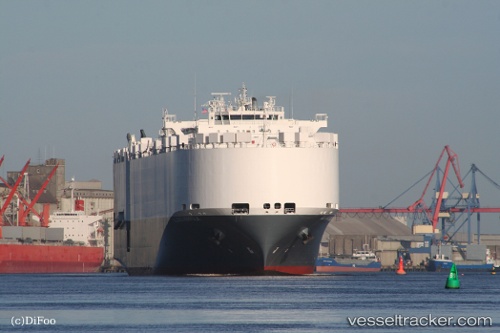
Alliance Norfolk
Current StatusWhere is the vessel?
Alliance Norfolk is currently in 142 nm SW of Gulfmex Lightering Area, based on AIS data received less than 1h ago.
Latest AIS update:
Current position: 25.77755° N, 92.29373° W (142 nm SW of Gulfmex Lightering Area)
Average speed (last 7 days): Loading…
Average speed (last 30 days): Loading…
Vessel profile: Alliance Norfolk is a Vehicles Carrier with dimensions 22m x 200m.
This page combines live AIS, route history, probable destination signals, nearby traffic, and port activity for practical vessel monitoring.
The current position of vessel Alliance Norfolk is 25.77755 lat / -92.29373 lng. Updated: 2026-05-16 15:56:55 UTCNearest reference points:
- 124 nm SW of Gulfmex Lightering Area
- 94 nm S of Gulfmex Lightering Area
- 83 nm W of Gulfmex Lightering Area
Details:
Live Vessel Alliance Norfolk Analytics (details, animations, etc.)
Recent AIS points (UTC):
2026-05-16 11:08:52 UTC · 25.11033, -91.11863 · SOG 16 kn · COG 306°2026-05-16 13:34:03 UTC · 25.46250, -91.71927 · SOG 15.6 kn · COG 301°
2026-05-16 14:10:13 UTC · 25.53633, -91.87145 · SOG 15.6 kn · COG 299°
2026-05-16 15:56:55 UTC · 25.77755, -92.29373 · SOG 14.4 kn · COG 302°