 vesseltracker.com
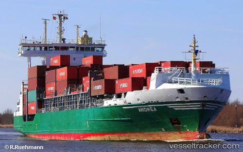
 ANDREA
Current Status
Where is the vessel?
ANDREA is currently in Near ALMADA, based on AIS data received less than 1h ago.
Latest AIS update:
Current position: 38.69923° N, 9.16686° W (Near ALMADA)
Average speed (last 7 days): Loading…
Average speed (last 30 days): Loading…
Vessel profile: ANDREA is a Container Ship with dimensions m x m.
This page combines live AIS, route history, probable destination signals, nearby traffic, and port activity for practical vessel monitoring.
The current position of vessel ANDREA is 38.69923 lat / -9.16686 lng. Updated: 2026-05-16 13:26:56 UTCNearest reference points:
- Near Lisboa
- Near Memória
- Near COVA DA PIEDADE
Currently sailing under the flag of Portugal ![]()
Details:
Live Vessel ANDREA Analytics (details, animations, etc.)
Recent AIS points (UTC):
2026-05-16 10:08:55 UTC · 38.69925, -9.16689 · SOG 0 kn · COG 77°2026-05-16 12:08:57 UTC · 38.69922, -9.16688 · SOG 0 kn · COG 77°
2026-05-16 13:11:57 UTC · 38.69923, -9.16686 · SOG 0 kn · COG 77°
2026-05-16 13:26:56 UTC · 38.69923, -9.16686 · SOG 0 kn · COG 77°