 vesseltracker.com
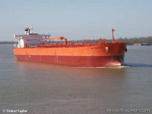
 Lillesand
Current Status
Where is the vessel?
Lillesand is currently in 14 nm SE of Licodia Eubea, based on AIS data received less than 1h ago.
Latest AIS update:
Current position: 37.00441° N, 15.92044° E (14 nm SE of Licodia Eubea)
Average speed (last 7 days): Loading…
Average speed (last 30 days): Loading…
Vessel profile: Lillesand is a Crude Oil Tanker with dimensions 239m x 42m.
This page combines live AIS, route history, probable destination signals, nearby traffic, and port activity for practical vessel monitoring.
The current position of vessel Lillesand is 37.00441 lat / 15.92044 lng. Updated: 2026-05-15 04:39:15 UTCNearest reference points:
- 24 nm S of Licodia Eubea
- 29 nm E of Licodia Eubea
- 34 nm NE of Villafranca Tirrena
Currently sailing under the flag of Bahamas ![]()
Lillesand built in 2007 year
Deadweight:
105786 tDetails:
Live Vessel Lillesand Analytics (details, animations, etc.)
Recent AIS points (UTC):
2026-05-14 23:52:10 UTC · 37.50256, 16.43999 · SOG 8 kn · COG 216°2026-05-15 01:16:26 UTC · 37.35526, 16.29122 · SOG 7.9 kn · COG 216°
2026-05-15 04:00:55 UTC · 37.07017, 15.99331 · SOG 8.3 kn · COG 218°
2026-05-15 04:39:15 UTC · 37.00441, 15.92044 · SOG 8.2 kn · COG 218°