 vesseltracker.com
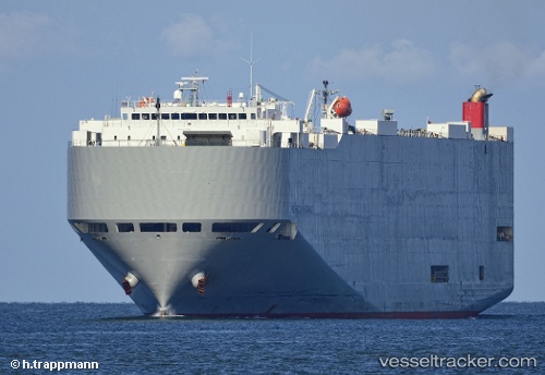
Michigan Highway
Current StatusWhere is the vessel?
Michigan Highway is currently in Open sea (no nearby ports in database), based on AIS data received less than 1h ago.
Latest AIS update:
Current position: 16.63102° S, 1.82458° E (Open sea (no nearby ports in database))
Average speed (last 7 days): Loading…
Average speed (last 30 days): Loading…
Vessel profile: Michigan Highway is a Vehicles Carrier with dimensions 32m x 199m.
This page combines live AIS, route history, probable destination signals, nearby traffic, and port activity for practical vessel monitoring.
The current position of vessel Michigan Highway is -16.63102 lat / 1.82458 lng. Updated: 2026-05-12 22:23:59 UTCNearest reference points:
- Open sea (no nearby ports in database)
Details:
Live Vessel Michigan Highway Analytics (details, animations, etc.)
Recent AIS points (UTC):
2026-05-12 19:18:44 UTC · -17.30613, 2.32591 · SOG 16.1 kn · COG 321°2026-05-12 19:55:11 UTC · -17.17297, 2.22674 · SOG 16.1 kn · COG 325°
2026-05-12 21:54:00 UTC · -16.73996, 1.90567 · SOG 15.9 kn · COG 324°
2026-05-12 22:23:59 UTC · -16.63102, 1.82458 · SOG 16 kn · COG 324°