 vesseltracker.com
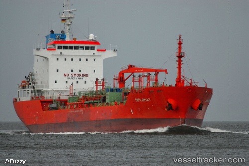
 Kaya Tuna
Current Status
Where is the vessel?
Kaya Tuna is currently in 15 nm N of ASTYPALEA, based on AIS data received less than 1h ago.
Latest AIS update:
Current position: 36.81190° N, 26.46633° E (15 nm N of ASTYPALEA)
Average speed (last 7 days): Loading…
Average speed (last 30 days): Loading…
Vessel profile: Kaya Tuna is a Chemical Oil Products Tanker with dimensions 128m x 21m.
This page combines live AIS, route history, probable destination signals, nearby traffic, and port activity for practical vessel monitoring.
The current position of vessel Kaya Tuna is 36.81190 lat / 26.46633 lng. Updated: 2026-03-30 19:48:06 UTCNearest reference points:
- 18 nm SW of PATMOS
- Near Aigiali Amorgou
- Near PATMOS
Currently sailing under the flag of Turkey ![]()
Kaya Tuna built in 2007 year
Deadweight:
13027 tDetails:
Live Vessel Kaya Tuna Analytics (details, animations, etc.)
Recent AIS points (UTC):
2026-03-30 13:59:27 UTC · 37.68468, 25.84706 · SOG 11.7 kn · COG 172°2026-03-30 15:43:46 UTC · 37.39676, 25.92816 · SOG 11.3 kn · COG 155°
2026-03-30 17:47:31 UTC · 37.04815, 26.11802 · SOG 11.3 kn · COG 156°
2026-03-30 19:48:06 UTC · 36.81190, 26.46633 · SOG 11.5 kn · COG 122°