 vesseltracker.com
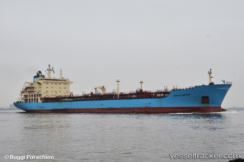
 M BRIGIT
Current Status
Where is the vessel?
M BRIGIT is currently in 19 nm NW of Mtwara, based on AIS data received less than 1h ago.
Latest AIS update:
Current position: 9.96333° S, 40.08667° E (19 nm NW of Mtwara)
Average speed (last 7 days): Loading…
Average speed (last 30 days): Loading…
Vessel profile: M BRIGIT is a Oil/Chemical Tanker with dimensions m x m.
This page combines live AIS, route history, probable destination signals, nearby traffic, and port activity for practical vessel monitoring.
The current position of vessel M BRIGIT is -9.96333 lat / 40.08667 lng. Updated: 2026-05-15 03:57:42 UTCNearest reference points:
- Near Mtwara
- 64 nm NE of Mtwara
Currently sailing under the flag of Singapore ![]()
Details:
Live Vessel M BRIGIT Analytics (details, animations, etc.)
Recent AIS points (UTC):
2026-05-14 22:38:49 UTC · -10.05166, 40.16333 · SOG 1 kn · COG -1°2026-05-15 00:15:08 UTC · -10.02667, 40.14333 · SOG 1 kn · COG -1°
2026-05-15 03:27:35 UTC · -9.97166, 40.09333 · SOG 1 kn · COG -1°
2026-05-15 03:57:42 UTC · -9.96333, 40.08667 · SOG 1 kn · COG -1°