 vesseltracker.com
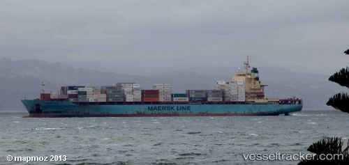
 Sine A
Current Status
Where is the vessel?
Sine A is currently in 16 nm SW of Forte da Casa, based on AIS data received less than 1h ago.
Latest AIS update:
Current position: 38.74754° N, 8.74387° E (16 nm SW of Forte da Casa)
Average speed (last 7 days): Loading…
Average speed (last 30 days): Loading…
Vessel profile: Sine A is a Container Ship with dimensions 222m x 222m.
This page combines live AIS, route history, probable destination signals, nearby traffic, and port activity for practical vessel monitoring.
The current position of vessel Sine A is 38.74754 lat / 8.74387 lng. Updated: 2026-04-03 22:21:07 UTCNearest reference points:
- Near SARROCH
- Near CARLOFORTE
- Near Cagliari
Currently sailing under the flag of Malta ![]()
Sine A built in 2008 year
Deadweight:
39426 tDetails:
Live Vessel Sine A Analytics (details, animations, etc.)
Recent AIS points (UTC):
2026-04-03 16:25:25 UTC · 38.97290, 9.24680 · SOG 0.2 kn · COG 64°2026-04-03 17:22:45 UTC · 38.97678, 9.24222 · SOG 0.6 kn · COG 41°
2026-04-03 20:29:08 UTC · 38.95366, 9.24352 · SOG 5.6 kn · COG 330°
2026-04-03 22:21:07 UTC · 38.74754, 8.74387 · SOG 16.9 kn · COG 251°