 vesseltracker.com
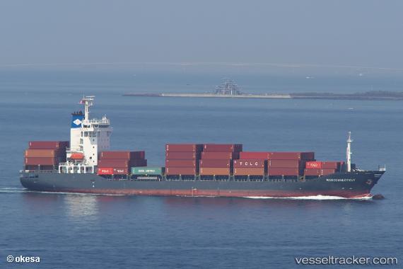
 Marconnecticut
Current Status
Where is the vessel?
Marconnecticut is currently in 26 nm SE of Maji Shan, based on AIS data received less than 1h ago.
Latest AIS update:
Current position: 30.39648° N, 122.80205° E (26 nm SE of Maji Shan)
Average speed (last 7 days): Loading…
Average speed (last 30 days): Loading…
Vessel profile: Marconnecticut is a Container Ship with dimensions 143m x 23m.
This page combines live AIS, route history, probable destination signals, nearby traffic, and port activity for practical vessel monitoring.
The current position of vessel Marconnecticut is 30.39648 lat / 122.80205 lng. Updated: 2026-05-13 04:04:53 UTCNearest reference points:
- 31 nm SE of Lü-hua Shan
- 36 nm E of JINHAI HEAVY INDUSTR
- 37 nm SE of Lü-hua Shan
Currently sailing under the flag of Antigua Barbuda ![]()
Marconnecticut built in 2007 year
Deadweight:
12774 tDetails:
Live Vessel Marconnecticut Analytics (details, animations, etc.)
Recent AIS points (UTC):
2026-05-12 23:28:54 UTC · 30.39733, 122.79998 · SOG 0.2 kn · COG 149°2026-05-13 01:04:53 UTC · 30.39722, 122.80005 · SOG 0.1 kn · COG 150°
2026-05-13 01:40:55 UTC · 30.39738, 122.80043 · SOG 0.2 kn · COG 168°
2026-05-13 04:04:53 UTC · 30.39648, 122.80205 · SOG 0.2 kn · COG 227°