 vesseltracker.com
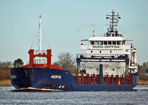
 Kertu
Kertu
Current Status
Where is the vessel?
Kertu is currently in Near TILBURY, based on AIS data received less than 1h ago.
Latest AIS update:
Current position: 51.45432° N, 0.35175° E (Near TILBURY)
Average speed (last 7 days): Loading…
Average speed (last 30 days): Loading…
Vessel profile: Kertu is a Multi Purpose Carrier with dimensions 101m x 15m.
This page combines live AIS, route history, probable destination signals, nearby traffic, and port activity for practical vessel monitoring.
The current position of vessel Kertu is 51.45432 lat / 0.35175 lng. Updated: 2026-05-15 07:08:58 UTCNearest reference points:
- Near Gravesend
- Near GILLINGHAM
- Near Blackheath/London
Currently sailing under the flag of Malta ![]()
Kertu built in 2005 year
Deadweight:
4800 tDetails:
Live Vessel Kertu Analytics (details, animations, etc.)
Recent AIS points (UTC):
2026-05-15 03:56:57 UTC · 51.45433, 0.35173 · SOG 0 kn · COG 62°2026-05-15 04:38:59 UTC · 51.45435, 0.35174 · SOG 0 kn · COG 62°
2026-05-15 06:17:57 UTC · 51.45433, 0.35172 · SOG 0 kn · COG 62°
2026-05-15 07:08:58 UTC · 51.45432, 0.35175 · SOG 0 kn · COG 62°