 vesseltracker.com
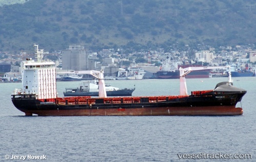
 Alexandra A
Current Status
Where is the vessel?
Alexandra A is currently in 53 nm E of Akhtopol, based on AIS data received less than 1h ago.
Latest AIS update:
Current position: 42.25557° N, 29.11202° E (53 nm E of Akhtopol)
Average speed (last 7 days): Loading…
Average speed (last 30 days): Loading…
Vessel profile: Alexandra A is a General Cargo Ship with dimensions 145m x 22m.
This page combines live AIS, route history, probable destination signals, nearby traffic, and port activity for practical vessel monitoring.
The current position of vessel Alexandra A is 42.25557 lat / 29.11202 lng. Updated: 2026-04-07 10:07:47 UTCNearest reference points:
- 38 nm E of IGNEADA
- 45 nm N of RUMELI FENERI
- 54 nm SE of Sveti Nikola
Currently sailing under the flag of Malta ![]()
Alexandra A built in 2011 year
Deadweight:
12099 tDetails:
Live Vessel Alexandra A Analytics (details, animations, etc.)
Recent AIS points (UTC):
2026-04-07 03:58:56 UTC · 41.33366, 29.18720 · SOG 9.7 kn · COG 12°2026-04-07 05:47:47 UTC · 41.61922, 29.17123 · SOG 8.6 kn · COG 355°
2026-04-07 07:23:51 UTC · 41.84500, 29.15124 · SOG 8.6 kn · COG -1°
2026-04-07 10:07:47 UTC · 42.25557, 29.11202 · SOG 9.4 kn · COG 358°