 vesseltracker.com
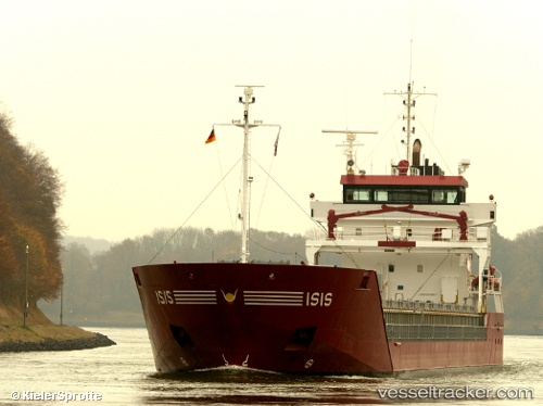
 Isis
Isis
Current Status
Where is the vessel?
Isis is currently in Near Cadgwith, based on AIS data received about 1h ago.
Latest AIS update:
Current position: 49.93162° N, 4.98044° W (Near Cadgwith)
Average speed (last 7 days): Loading…
Average speed (last 30 days): Loading…
Vessel profile: Isis is a Multi Purpose Carrier with dimensions 111m x 14m.
This page combines live AIS, route history, probable destination signals, nearby traffic, and port activity for practical vessel monitoring.
The current position of vessel Isis is 49.93162 lat / -4.98044 lng. Updated: 2026-05-15 06:00:08 UTCNearest reference points:
- Near Cadgwith
- Near Flushing
- Near Falmouth
Currently sailing under the flag of Netherlands ![]()
Isis built in 2007 year
Deadweight:
6000 tDetails:
Live Vessel Isis Analytics (details, animations, etc.)
Recent AIS points (UTC):
2026-05-15 03:45:46 UTC · 50.00087, -4.52137 · SOG 7.9 kn · COG 256°2026-05-15 03:48:27 UTC · 49.99943, -4.53022 · SOG 7.9 kn · COG 257°
2026-05-15 05:07:45 UTC · 49.95652, -4.79564 · SOG 8.3 kn · COG 257°
2026-05-15 06:00:08 UTC · 49.93162, -4.98044 · SOG 8.7 kn · COG 262°