 vesseltracker.com
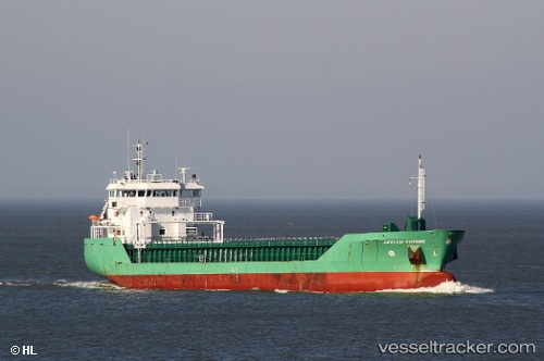
 HAV SUND
Current Status
Where is the vessel?
HAV SUND is currently in Near Hansweert/Schore, based on AIS data received about 3h ago.
Latest AIS update:
Current position: 51.42642° N, 3.97433° E (Near Hansweert/Schore)
Average speed (last 7 days): Loading…
Average speed (last 30 days): Loading…
Vessel profile: HAV SUND is a General Cargo Ship with dimensions 90m x 15m.
This page combines live AIS, route history, probable destination signals, nearby traffic, and port activity for practical vessel monitoring.
The current position of vessel HAV SUND is 51.42642 lat / 3.97433 lng. Updated: 2026-05-13 05:43:51 UTCNearest reference points:
- Near Hansweert/Schore
- Near S Heer Arendskerke
- Near Baarland
Currently sailing under the flag of Faroe Islands ![]()
HAV SUND built in 2008 year
Deadweight:
4950 tDetails:
Live Vessel HAV SUND Analytics (details, animations, etc.)
Recent AIS points (UTC):
2026-05-13 02:16:12 UTC · 51.59104, 3.38154 · SOG 10.3 kn · COG 147°2026-05-13 03:55:50 UTC · 51.42218, 3.59301 · SOG 7.6 kn · COG 84°
2026-05-13 04:06:05 UTC · 51.42347, 3.62712 · SOG 10.4 kn · COG 90°
2026-05-13 05:43:51 UTC · 51.42642, 3.97433 · SOG 11.7 kn · COG 29°