 vesseltracker.com
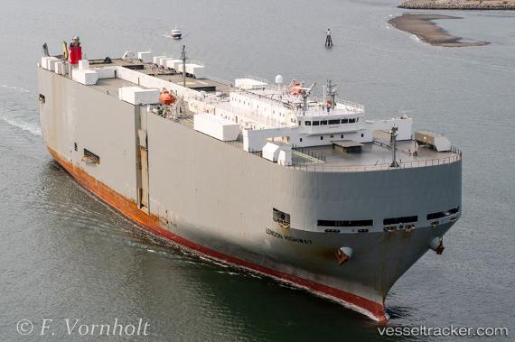
London Highway
Current StatusWhere is the vessel?
London Highway is currently in 24 nm S of Punta de Maisi, based on AIS data received about 1h ago.
Latest AIS update:
Current position: 19.87344° N, 73.99058° W (24 nm S of Punta de Maisi)
Average speed (last 7 days): Loading…
Average speed (last 30 days): Loading…
Vessel profile: London Highway is a Vehicles Carrier with dimensions 32m x 199m.
This page combines live AIS, route history, probable destination signals, nearby traffic, and port activity for practical vessel monitoring.
The current position of vessel London Highway is 19.87344 lat / -73.99058 lng. Updated: 2026-05-16 14:30:17 UTCNearest reference points:
- 56 nm SW of Cockburn Harbour
- 47 nm SW of Cockburn Harbour
- 38 nm SW of Cockburn Harbour
Details:
Live Vessel London Highway Analytics (details, animations, etc.)
Recent AIS points (UTC):
2026-05-16 11:12:11 UTC · 19.07054, -74.53560 · SOG 17.2 kn · COG 24°2026-05-16 13:32:46 UTC · 19.64170, -74.14553 · SOG 17.6 kn · COG 36°
2026-05-16 13:32:46 UTC · 19.64170, -74.14553 · SOG 17.6 kn · COG 36°
2026-05-16 14:30:17 UTC · 19.87344, -73.99058 · SOG 16.8 kn · COG 31°