 vesseltracker.com
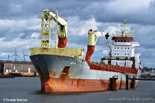
 Onego Bayou
Current Status
Where is the vessel?
Onego Bayou is currently in Near San Juan de Nieva, based on AIS data received less than 1h ago.
Latest AIS update:
Current position: 43.57607° N, 5.92021° W (Near San Juan de Nieva)
Average speed (last 7 days): Loading…
Average speed (last 30 days): Loading…
Vessel profile: Onego Bayou is a Multi Purpose Carrier with dimensions 145m x 145m.
This page combines live AIS, route history, probable destination signals, nearby traffic, and port activity for practical vessel monitoring.
The current position of vessel Onego Bayou is 43.57607 lat / -5.92021 lng. Updated: 2026-05-13 12:03:02 UTCNearest reference points:
- Near San Juan de Nieva
- Near Musel-Arnao
- Near Tremanes
Currently sailing under the flag of Antigua Barbuda ![]()
Onego Bayou built in 2007 year
Deadweight:
10758 tDetails:
Live Vessel Onego Bayou Analytics (details, animations, etc.)
Recent AIS points (UTC):
2026-05-13 06:09:03 UTC · 43.57612, -5.92014 · SOG 0 kn · COG 175°2026-05-13 10:18:04 UTC · 43.57610, -5.92017 · SOG 0 kn · COG 175°
2026-05-13 10:42:03 UTC · 43.57608, -5.92020 · SOG 0 kn · COG 175°
2026-05-13 12:03:02 UTC · 43.57607, -5.92021 · SOG 0 kn · COG 175°