 vesseltracker.com
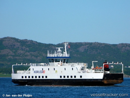
 Ytteroyningen
Current Status
Where is the vessel?
Ytteroyningen is currently in Near Halsnøy, based on AIS data received about 1h ago.
Latest AIS update:
Current position: 59.73119° N, 5.69545° E (Near Halsnøy)
Average speed (last 7 days): Loading…
Average speed (last 30 days): Loading…
Vessel profile: Ytteroyningen is a Passenger Ro Ro Cargo Ship with dimensions 48m x 16m.
This page combines live AIS, route history, probable destination signals, nearby traffic, and port activity for practical vessel monitoring.
The current position of vessel Ytteroyningen is 59.73119 lat / 5.69545 lng. Updated: 2026-05-14 17:25:54 UTCNearest reference points:
- Near Halsnøy
- Near Valevåg
- Near ROSENDAL
Currently sailing under the flag of Norway ![]()
Ytteroyningen built in 2006 year
Deadweight:
343 tDetails:
Live Vessel Ytteroyningen Analytics (details, animations, etc.)
Recent AIS points (UTC):
2026-05-14 14:09:24 UTC · 59.73402, 5.70411 · SOG 9.8 kn · COG 89°2026-05-14 16:08:34 UTC · 59.72876, 5.72429 · SOG 10.3 kn · COG 249°
2026-05-14 16:17:51 UTC · 59.73763, 5.70837 · SOG 2.4 kn · COG 311°
2026-05-14 17:25:54 UTC · 59.73119, 5.69545 · SOG 0 kn · COG 264°