 vesseltracker.com
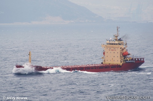
 MCP AMSTERDAM
Current Status
Where is the vessel?
MCP AMSTERDAM is currently in 10 nm S of ZHOUSHAN, based on AIS data received less than 1h ago.
Latest AIS update:
Current position: 29.79837° N, 122.16311° E (10 nm S of ZHOUSHAN)
Average speed (last 7 days): Loading…
Average speed (last 30 days): Loading…
Vessel profile: MCP AMSTERDAM is a General Cargo with dimensions m x m.
This page combines live AIS, route history, probable destination signals, nearby traffic, and port activity for practical vessel monitoring.
The current position of vessel MCP AMSTERDAM is 29.79837 lat / 122.16311 lng. Updated: 2026-05-14 17:35:15 UTCNearest reference points:
- 10 nm SE of Daxie Pt
- Near ZHOUSHAN
- 11 nm S of ZHOUSHAN
Details:
Live Vessel MCP AMSTERDAM Analytics (details, animations, etc.)
Recent AIS points (UTC):
2026-05-14 14:05:15 UTC · 29.79837, 122.16317 · SOG 0 kn · COG 319°2026-05-14 15:44:15 UTC · 29.79834, 122.16309 · SOG 0 kn · COG 319°
2026-05-14 16:53:15 UTC · 29.79832, 122.16312 · SOG 0 kn · COG 319°
2026-05-14 17:35:15 UTC · 29.79837, 122.16311 · SOG 0 kn · COG 319°