 vesseltracker.com
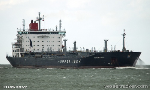
 ROYAL JASMINE
Current Status
Where is the vessel?
ROYAL JASMINE is currently in Near Batangas/Luzon, based on AIS data received about 1h ago.
Latest AIS update:
Current position: 13.72291° N, 121.05683° E (Near Batangas/Luzon)
Average speed (last 7 days): Loading…
Average speed (last 30 days): Loading…
Vessel profile: ROYAL JASMINE is a Oil/Chemical Tanker with dimensions m x m.
This page combines live AIS, route history, probable destination signals, nearby traffic, and port activity for practical vessel monitoring.
The current position of vessel ROYAL JASMINE is 13.72291 lat / 121.05683 lng. Updated: 2026-04-24 00:00:38 UTCNearest reference points:
- Near Lobo
- 12 nm S of Lobo
- Near Nasugbu, Luzon
Currently sailing under the flag of Marshall Islands ![]()
Details:
Live Vessel ROYAL JASMINE Analytics (details, animations, etc.)
Recent AIS points (UTC):
2026-04-23 19:57:40 UTC · 13.72285, 121.05680 · SOG 0 kn · COG 345°2026-04-23 22:06:38 UTC · 13.72288, 121.05681 · SOG 0 kn · COG 346°
2026-04-23 22:54:40 UTC · 13.72290, 121.05682 · SOG 0 kn · COG 346°
2026-04-24 00:00:38 UTC · 13.72291, 121.05683 · SOG 0 kn · COG 346°