 vesseltracker.com
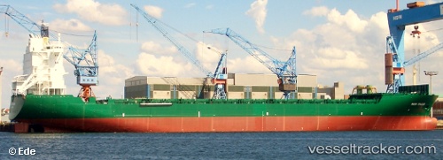
 PAPU
PAPU
Current Status
Where is the vessel?
PAPU is currently in 85 nm SE of Kárpathos, based on AIS data received about 1h ago.
Latest AIS update:
Current position: 34.75731° N, 28.70168° E (85 nm SE of Kárpathos)
Average speed (last 7 days): Loading…
Average speed (last 30 days): Loading…
Vessel profile: PAPU is a Container Ship with dimensions m x m.
This page combines live AIS, route history, probable destination signals, nearby traffic, and port activity for practical vessel monitoring.
The current position of vessel PAPU is 34.75731 lat / 28.70168 lng. Updated: 2026-04-29 01:34:08 UTCNearest reference points:
- 108 nm S of Kastellorizou (ex Megísti)
- 129 nm NW of ABU QIR
- 91 nm SE of Polychnitos Lesvou
Currently sailing under the flag of Liberia ![]()
Details:
Live Vessel PAPU Analytics (details, animations, etc.)
Recent AIS points (UTC):
2026-04-28 22:46:15 UTC · 35.38710, 28.01971 · SOG 18.3 kn · COG 135°2026-04-28 23:29:56 UTC · 35.22434, 28.20006 · SOG 18 kn · COG 136°
2026-04-29 00:26:14 UTC · 35.01339, 28.42948 · SOG 17.9 kn · COG 136°
2026-04-29 01:34:08 UTC · 34.75731, 28.70168 · SOG 18.1 kn · COG 138°