 vesseltracker.com
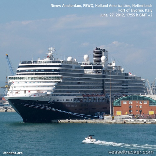
 Nieuw Amsterdam
Current Status
Where is the vessel?
Nieuw Amsterdam is currently in 21 nm S of Ketchikan, based on AIS data received less than 1h ago.
Latest AIS update:
Current position: 54.98916° N, 131.72012° W (21 nm S of Ketchikan)
Average speed (last 7 days): Loading…
Average speed (last 30 days): Loading…
Vessel profile: Nieuw Amsterdam is a Cruise Ship with dimensions 285m x 36m.
This page combines live AIS, route history, probable destination signals, nearby traffic, and port activity for practical vessel monitoring.
The current position of vessel Nieuw Amsterdam is 54.98916 lat / -131.72012 lng. Updated: 2026-05-15 04:38:05 UTCNearest reference points:
- Near Ward Cove
- 15 nm N of Port Clements
- Near Prince Rupert
Currently sailing under the flag of Netherlands ![]()
Nieuw Amsterdam built in 2010 year
Deadweight:
8754 tDetails:
Live Vessel Nieuw Amsterdam Analytics (details, animations, etc.)
Recent AIS points (UTC):
2026-05-15 00:07:54 UTC · 55.34019, -131.64656 · SOG 0 kn · COG 141°2026-05-15 01:16:56 UTC · 55.34019, -131.64658 · SOG 0 kn · COG 141°
2026-05-15 03:22:06 UTC · 55.26609, -131.62668 · SOG 10.8 kn · COG 204°
2026-05-15 04:38:05 UTC · 54.98916, -131.72012 · SOG 14 kn · COG 186°