 vesseltracker.com
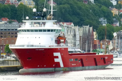
 SEEKER TIDE
Current Status
Where is the vessel?
SEEKER TIDE is currently in Near Muara, based on AIS data received about 1h ago.
Latest AIS update:
Current position: 5.07548° N, 115.09251° E (Near Muara)
Average speed (last 7 days): Loading…
Average speed (last 30 days): Loading…
Vessel profile: SEEKER TIDE is a Offshore Supply Ship with dimensions m x m.
This page combines live AIS, route history, probable destination signals, nearby traffic, and port activity for practical vessel monitoring.
The current position of vessel SEEKER TIDE is 5.07548 lat / 115.09251 lng. Updated: 2026-04-27 20:29:51 UTCNearest reference points:
- Near Kikeh
- 11 nm N of MIRI
- Near MIRI
Currently sailing under the flag of United Kingdom ![]()
Details:
Live Vessel SEEKER TIDE Analytics (details, animations, etc.)
Recent AIS points (UTC):
2026-04-27 16:14:49 UTC · 5.07502, 115.09217 · SOG 0 kn · COG 93°2026-04-27 18:23:48 UTC · 5.07543, 115.09240 · SOG 0 kn · COG 140°
2026-04-27 19:44:48 UTC · 5.07549, 115.09239 · SOG 0 kn · COG 135°
2026-04-27 20:29:51 UTC · 5.07548, 115.09251 · SOG 0 kn · COG 143°