 vesseltracker.com
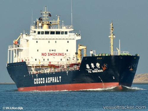
 PARITOSH
Current Status
Where is the vessel?
PARITOSH is currently in 11 nm NW of Jazireh-Ye Sirri, based on AIS data received about 1h ago.
Latest AIS update:
Current position: 26.03958° N, 54.41605° E (11 nm NW of Jazireh-Ye Sirri)
Average speed (last 7 days): Loading…
Average speed (last 30 days): Loading…
Vessel profile: PARITOSH is a Asphalt/Bitumen Tanker with dimensions m x m.
This page combines live AIS, route history, probable destination signals, nearby traffic, and port activity for practical vessel monitoring.
The current position of vessel PARITOSH is 26.03958 lat / 54.41605 lng. Updated: 2026-05-02 18:45:48 UTCNearest reference points:
- 11 nm SW of Fateh Terminal
- Near LENGEH
- 17 nm NW of Free Port
Currently sailing under the flag of Comoros ![]()
Details:
Live Vessel PARITOSH Analytics (details, animations, etc.)
Recent AIS points (UTC):
2026-05-02 16:49:14 UTC · 26.04335, 54.65771 · SOG 6.2 kn · COG 279°2026-05-02 17:21:44 UTC · 26.04381, 54.59317 · SOG 6.4 kn · COG 269°
2026-05-02 18:45:48 UTC · 26.03958, 54.41605 · SOG 7.1 kn · COG 276°
2026-05-02 18:45:48 UTC · 26.03958, 54.41605 · SOG 7.1 kn · COG 276°